Trekking Ring of the Central Massif, Picos de Europa
TREKKING Ring of the Picos de Europa Central Massif
Manaslu Adventures offers you a fabulous circular trekking through the Picos de Europa, located in the mountain system shared by Asturias, Cantabria and Castilla y León. The Picos are surely one of the most beautiful and little-traveled places on the Iberian Peninsula. There will be five days dedicated to the discovery of the most abrupt of its massifs. Through a route that takes us through the different refuges of these mountains we get to know the most representative paths and peaks of the Urrieles. It is in the Central Massif or Los Urrieles Massif, where these Cantabrian mountains reach their maximum expression, with an unbeatable environment of very high mountains, rivers, rocks and steep peaks, which will not be possible to match in any other Spanish mountain range. Other mountains will be higher, but these are the most untamed and wild. A journey that will cover the best of Picos de Europa with stages well guarded by its refuges and that will allow us to get closer to the highest peak of Picos de Europa, Torrecerredo, and the mythical Naranjo de Bulnes, indisputable symbol of the Picos de Europa.
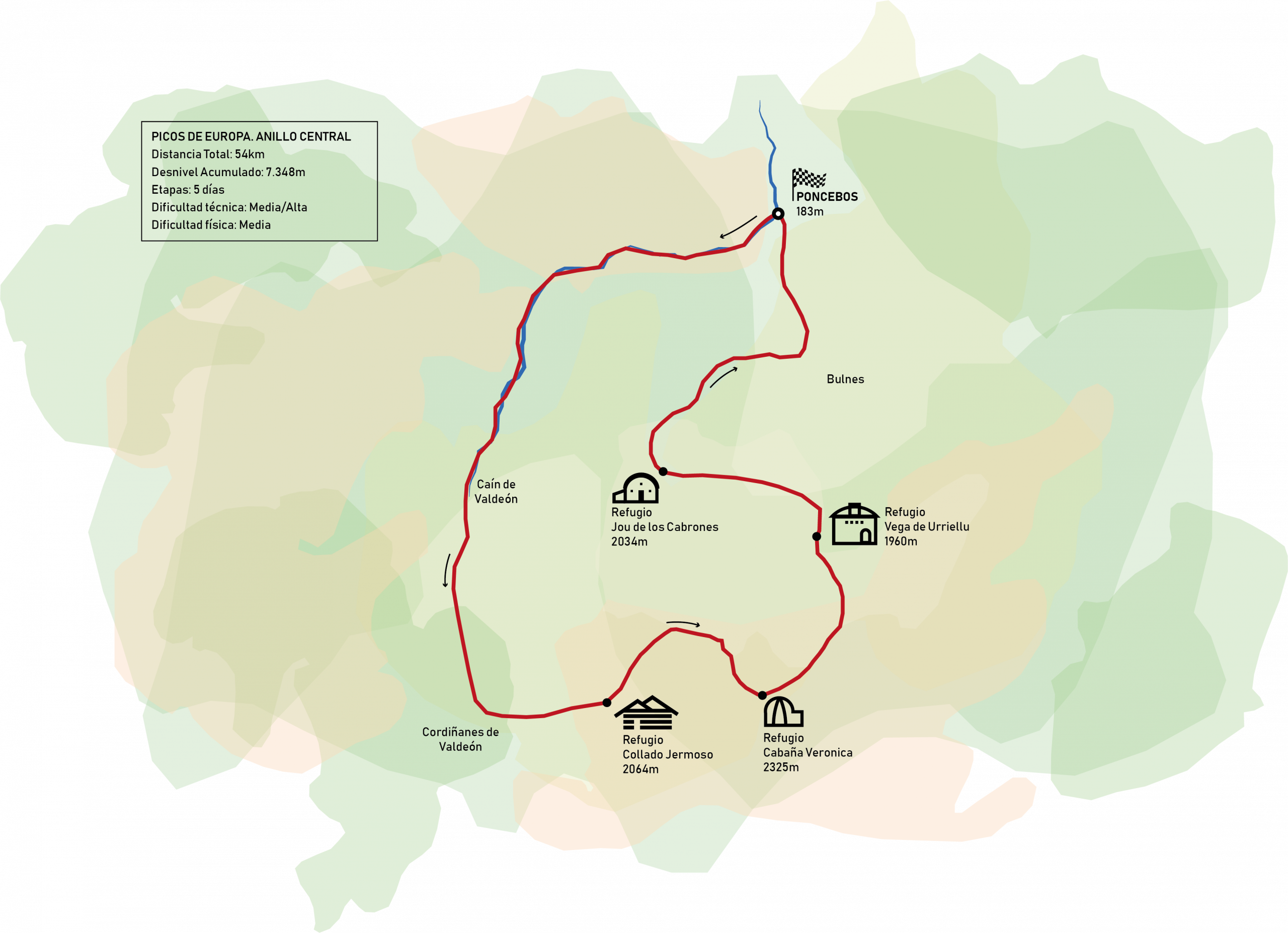
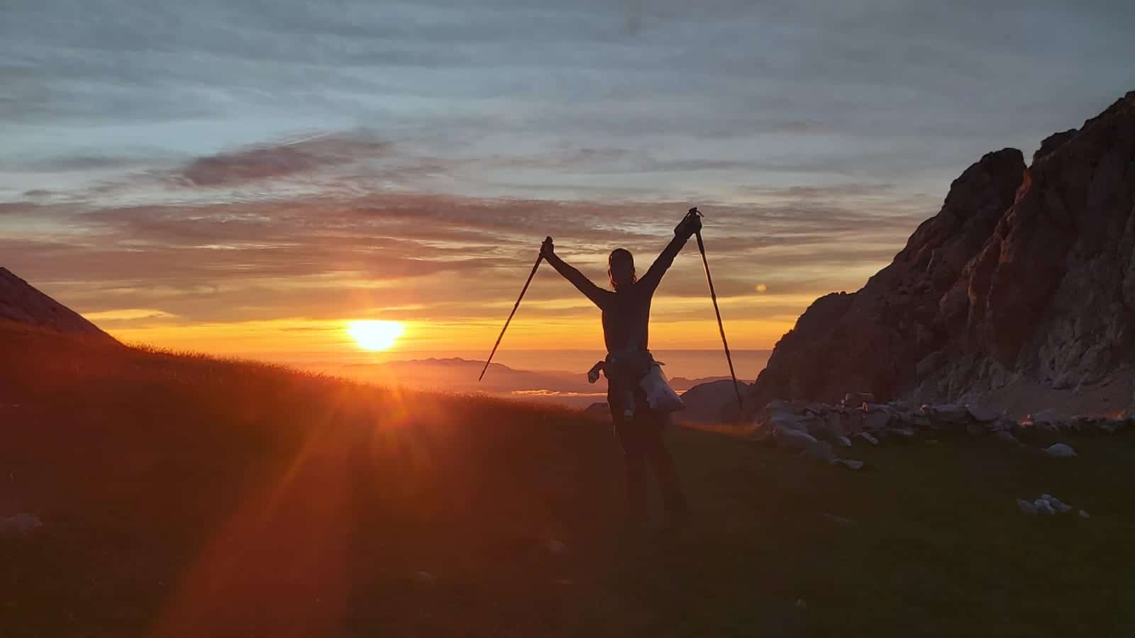
We will travel 54 km with a cumulative elevation gain of 7,348m. A fantastic circular trekking in the heart of the Picos de Europa, such spectacular places and refuges in incredible places that will make us enjoy nature in its purest form. Great climbs, high altitude crossings, glacial valleys await us. We will walk along many paths that were created over many years of work and that today offer us the possibility of traveling and getting to know the wonderful Los Picos de Europa National Park. And this is what it is about, enjoying the mountains. Living a little of the experience of walking through an environment like the Picos de Europa, surrounded by those imposing peaks, is an experience that you will never forget.
Trip details
Available dates
From August 22 to 27
Trekking that can be done from June 1 to October 15, 2021. For other dates, contact us.
Duration
5 days of Trekking
Groups
From 4 to 10 people.
Accommodation
5 nights in Hostels on Half Board Regime.
Difficulty level
Technical difficulty: Medium/High
Physical difficulty: Medium
Equipment
Backpack 30-35 liters capacity.
Mid-cut hiking boots.
Water container (minimum 1 liter per person).
Telescopic trekking poles (optional but recommended).
Shorts.
Long pants.
2 Pairs of socks above the ankle.
2 Technical T-shirts (first layer).
1 Long sleeve t-shirt.
1 Jacket or fleece (second layer).
Gore-Tex jacket or similar (third layer).
Sunglasses.
Sun cream.
First aid kit with personal medications and thermal blanket.
Front light with spare batteries.
Gloves.
Hat.
Energy drink and food (fruit, bars, nuts, …).
Sleeping bag and slippers for shelter and personal hygiene utensils.
Mobile phone with a charged battery and cable to charge it.
DNI.
Cash.
Federal card, if possessed.
DAY BY DAY ITINERARY
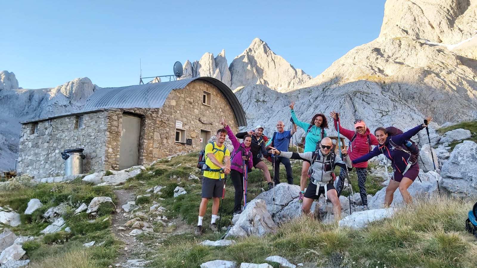
Travel by own vehicle to Arena de Cabrales (Asturias). Meeting with the group at the Hostel around 7 pm. The guide will give a brief presentation of the program and we will enjoy a delicious dinner in the town.
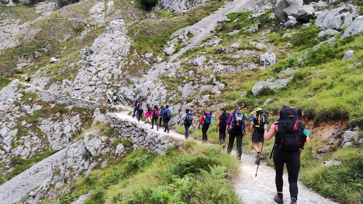
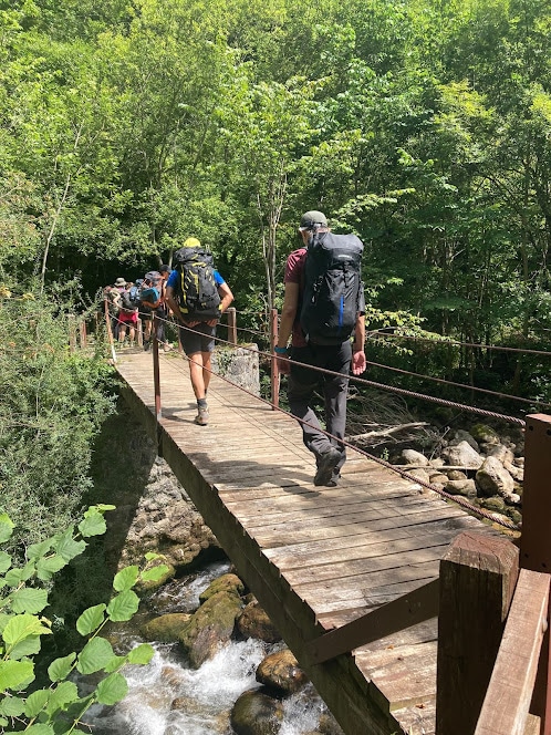
We will begin the journey with the famous Cares Route. The surroundings are beautiful and, except for the hill at the beginning, it will then be 11 kilometers flat along the Cares River gorge to the town of Caín. It is a spectacular site on a geological level and for its human history. This road was built between 1945 and 1951 to carry out maintenance on the canal that carries water from Caín to Camermeña and then to the Poncebos Power Plant. It was the first power plant built in Spain in 1921 and the second in Europe, after the first in England in 1880. Formerly there was a road to access the imposing canal work, some remains of which can still be seen. The construction of the canal began in 1916 and ended in 1921. More than 400 people worked on this work at one time. We will continue walking to the Bolín bridge, where we will have a fountain.
After about 2 km we will arrive at Caín (León), a characteristic town of shepherds and mountaineers. Here we can regain strength to face the last kilometers to Cordiñanes.
Distance: 19 km.
Positive gradient: 750 m.
Negative slope: 172 m.
Physical difficulty: Easy
Technical Difficulty: Easy
Accommodation: Hostel in Cordiñanes
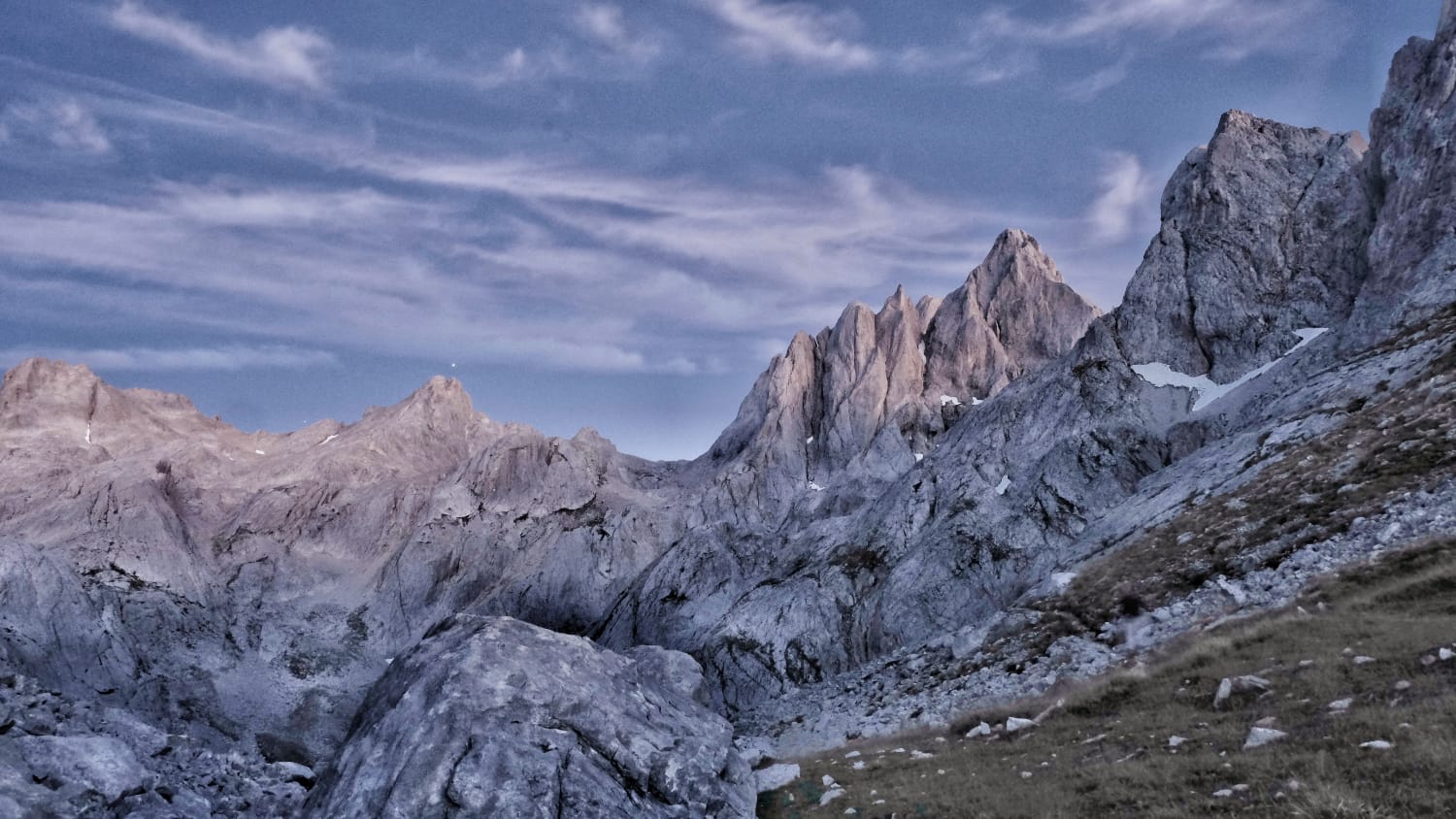
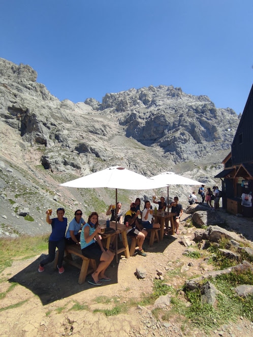
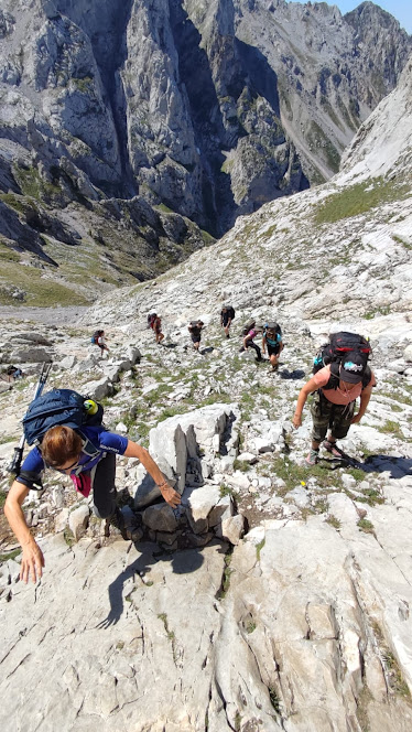
We will climb to Collado Jermoso, entering through an incredible path carved into the rock, known as the Rienda, which will leave us in the shadow of the beech forest and Vega de Asotín. The contrast between the beech trees, the meadow and the imposing mass of the Torre del Friero make this landscape one of the most impressive sites in Picos de Europa. From now on, a world of rocks and canals awaits us to reach the Argayo Congosto, steep terrain, where we will have to help ourselves by hand to reach the refuge.
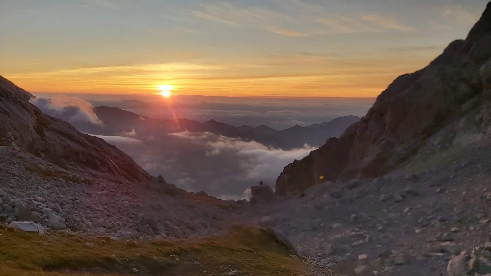
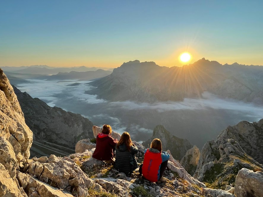
Here we can enjoy one of the most spectacular sunsets in all of Picos de Europa.
Distance: 8 km.
Positive gradient: 1402 m.
Negative slope: 260 m.
Physical difficulty: High.
Technical Difficulty: Medium
Accommodation: Diego Mella Refuge / Collado Jermoso
(J. Delgado Úbeda Shelter, 1900m).
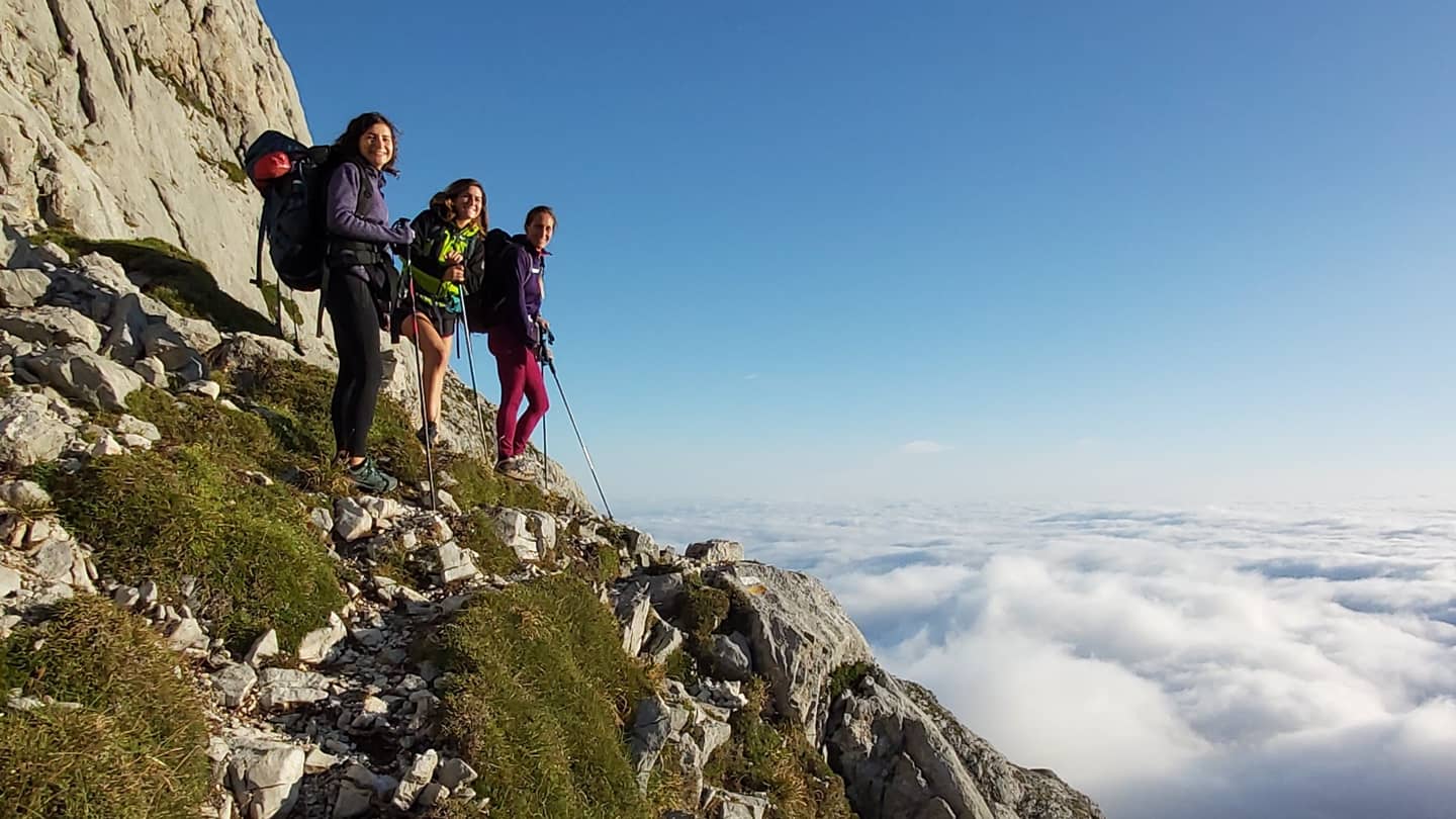
Today we will enjoy this magnificent Massif. We will pass through “lunar” areas between jous, lapiaz, llambrias and peaks. We will enjoy jumping from rock to rock like dwarfs!
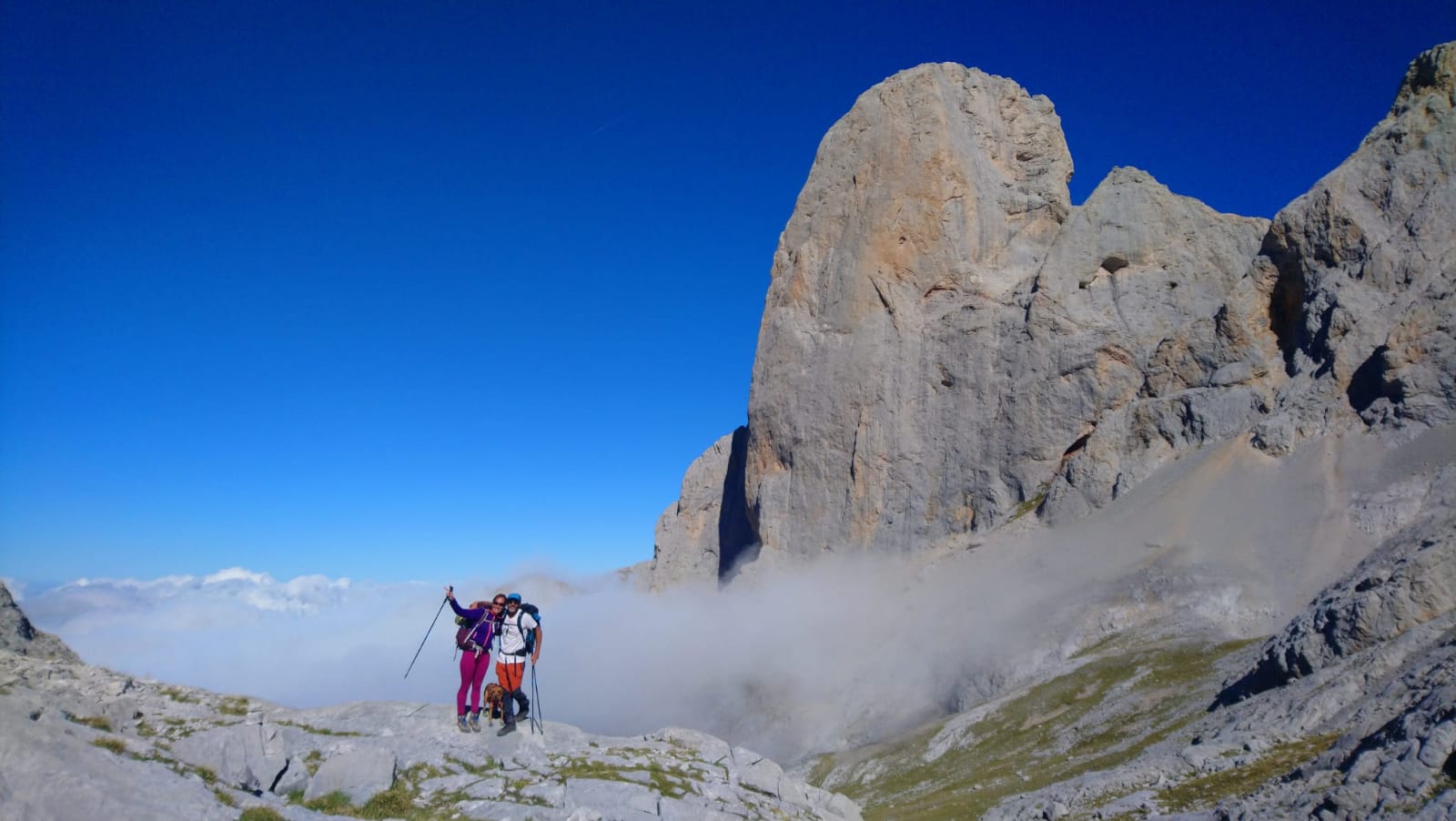
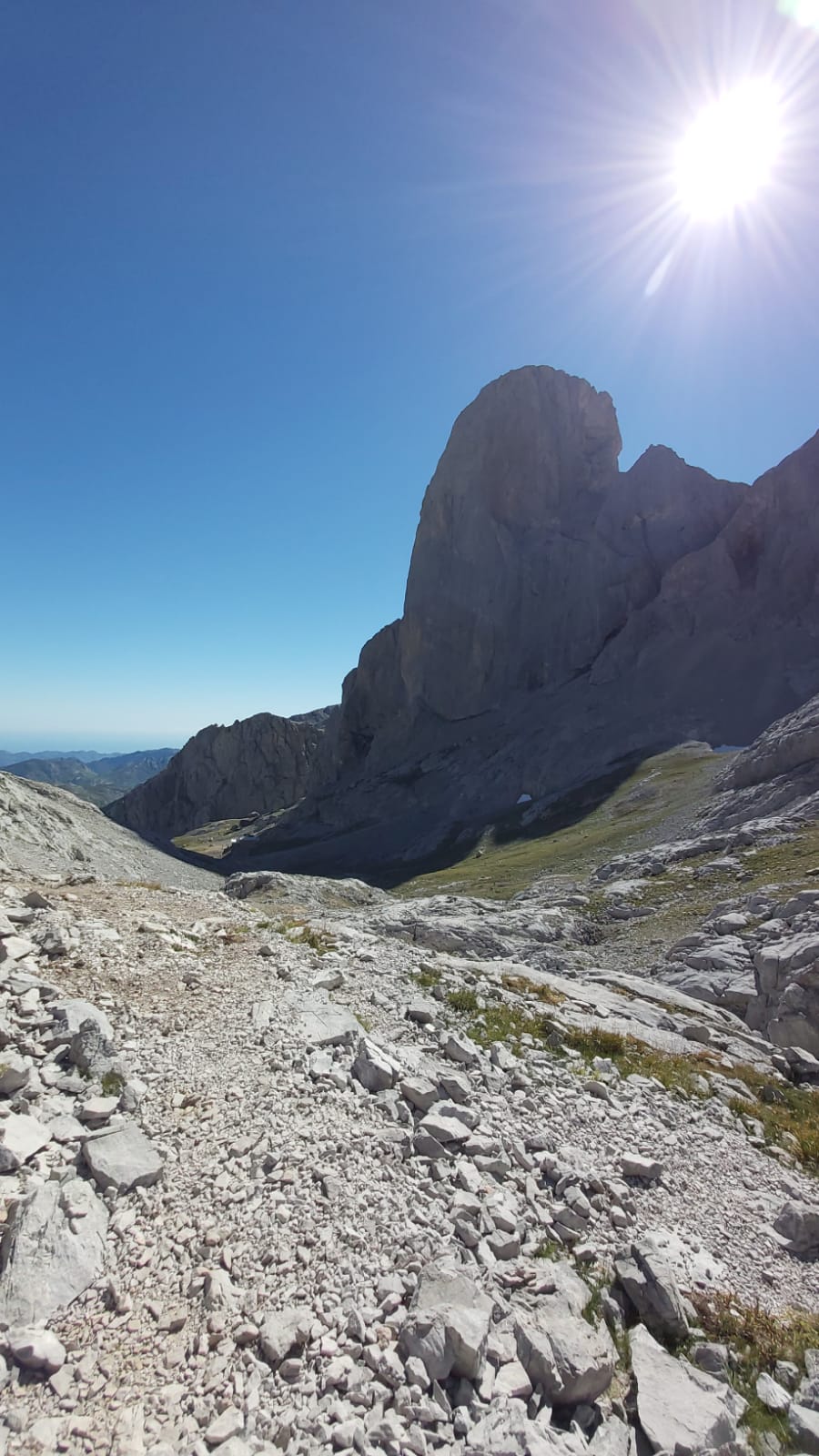
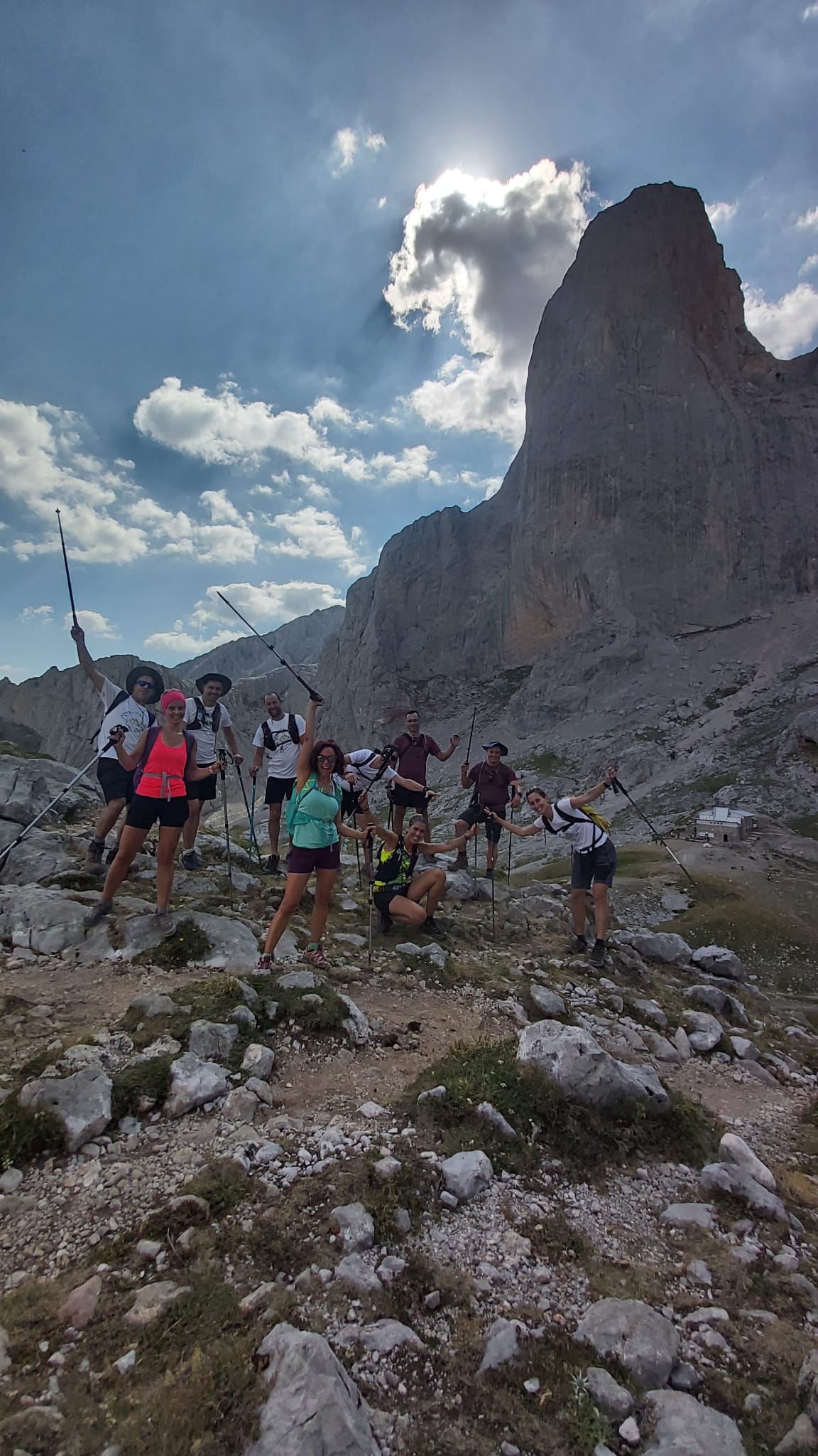
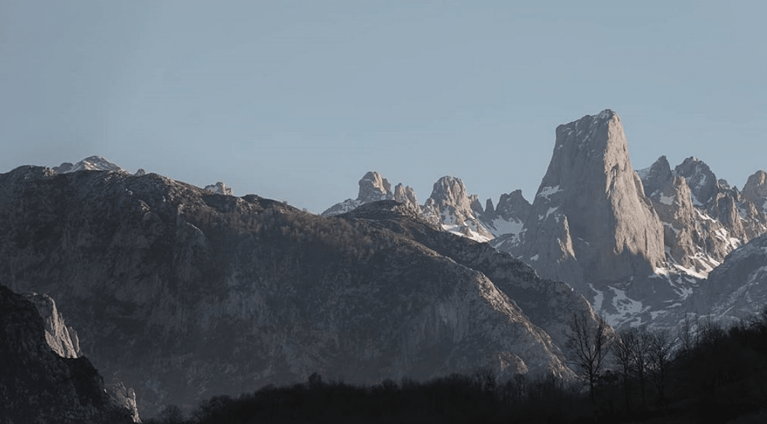
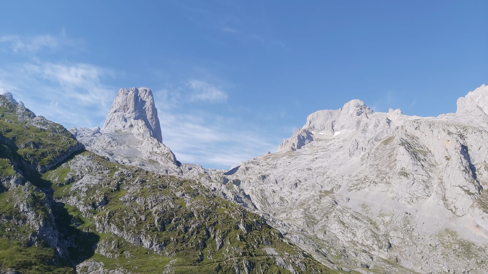
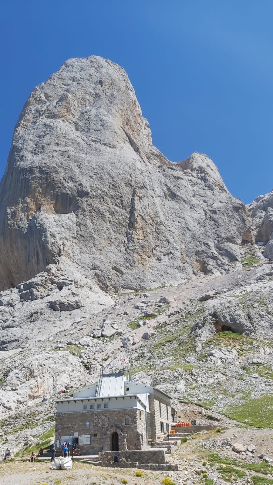
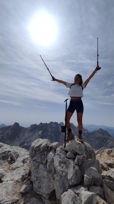
We will arrive at Cabaña Verónica, the most characteristic refuge in Picos de Europa. It is an old dome of a ship cannon, transformed into a shelter, it is worth stopping and entering. We will be surrounded by large mountains such as Pico Tesorero, Horcados Rojos, Peña Vieja, La Palanca and others. We will go down to the crossing through Peña Vieja and here we will go up along a zigzag path between rock fields. We will arrive at the foot of Peña Vieja and a “lunar” landscape of karst and jous rocks will open up in front of us. We will pass through the Collado de Santa Ana that will allow us to access the Jou de los Boches. The descents on the rocks will be very fun. It’s almost time to see the king of Picos de Europa. We will pass the Jou Sin Tierre and there He, the king, El Picu will appear before our eyes. We will be right at your feet. With its 2519m it is one of the most emblematic peaks in Spain and one of the most desired goals for all climbers. It stands out from the point of view of climbing large walls, especially for the 550 meters of vertical wall on its west face. We will go down to the Vega de Urriellu, a wide valley of glacial origin where the Delgado Úbeda Refuge is located.
Distance: 11.36 km.
Positive gradient: 900 m.
Negative gradient: 1031 m.
Physical difficulty: High.
Technical Difficulty: Medium.
Accommodation: J.Delgado Refuge Úbeda / Vega de Urriellu
II Option: Ascension to the Torre de la Párdida (2582m) from Horcada Arenera. It is an ascent without technical difficulty but with incredible views of the Central Massif. We will leave our backpacks downstairs, so we will go up lighter. (3.3 km and 330m+ must be added).
The route is spectacular, it is not very long and at the same time demanding. We salute The King of Peaks and head towards the Jou de los Cabrones. We will continue in high mountain terrain: we will be surrounded by jous and high mountains and we will walk over rocks, lapiaz, llambrias and loose stones.
Nothing complicated! We will pass through Corona El Rasu, a narrow rocky outcrop that will give a bit more adventure to our trekking.
We will arrive at the Horcada Arenera (2279m), a great place for a future bivouac. We will detour to the foot of Torre Cerredo, the highest mountain in Asturias, with its 2646m. We will pass near Jou Negro, a glaciokarstic depression developed north of Torre Cerredo. It contains a mass of ice of glacial origin, which is usually hidden under a cover of snow and slush. In the northern part, a moraine corresponding to the historical post-glacial stage is preserved.
We will continue our route towards the Jou de los Cabrones passing through karst, jous and llambrías areas and we will arrive at the José Ramón Lueje Refuge, at 2034m above sea level, the highest of all the refuges in Asturias and one of the most difficult to reach. reach. The name Jou de los Cabrones derives from the large goats that existed in the Picos de Europa in times past, known as “mueños”, now extinct. Its surroundings are surrounded by high peaks and beautiful ascents of all types of difficulty: Cuetos del Trave, Albos, Dobresengos, Pico y Agujas de los Cabrones, Torre Cerredo, la Bermeja, la Párdida, Neverón de Urriellu…
Likewise, the area is full of deep chasms for practicing caving. This place is called the Himalaya of the Chasms because of the many chasms that exceed 1000 meters deep. Among them, the Torca del Cerro is the deepest in Spain with more than 1800 m deep and the second in the world, on the other hand this chasm is the most difficult worldwide.
Distance: 6.72 km.
Positive gradient: 510 m.
Negative slope: 423 m.
Physical difficulty: Medium.
Technical Difficulty: Medium.
Accommodation: Ramón Lueje Refuge / Jou de los Cabrones
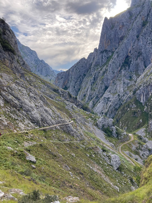
The last day is almost entirely downhill. After overcoming the northern hill that gives access to the Jou de los Cabrones, the path continues along the Cuesta del Trave in a northerly direction, until reaching the Collado de summit, where the ruins of the Majada de Amuesa are located. It is a magnificent one, which still preserves its shepherds’ huts, its livestock and remains of ancient huts built in dry stones. From here we will have a long zigzag descent along the Amuesa Canal. And for the more adventurous, you can go down a section along the rocky slope. We will arrive at the Barrio del Castillo, and finally we will take the path that descends to the Villa de Bulnes, an ideal place to eat and rest after the journey. It is one of the most remote and isolated towns in Asturias, where you cannot reach it by car. Until 18 years ago it could only be reached by trails. Now there is a funicular that goes up from Poncebos. It is a shepherd’s village, carved between rocks of extraordinary beauty, made up of rustic houses, and has always been traveled by many mountaineers.
From Bulnes, we will take the Canal del Texu to reach Poncebos. This is one of the two routes that the shepherds and inhabitants of Bulnes have always used to reach this beautiful town. It coincides with a section of the Reconquista Route, a path that the Moors used to escape from Don Pelayo’s army in 722 AD after the defeat of the Battle of Covadonga. We will arrive in Poncebos with a big smile for having enjoyed a beautiful trekking in Picos de Europa.
Distance: 9 km.
Positive slope: 150 m.
Negative slope: 1750 m.
Physical difficulty: Medium.
Technical Difficulty: Medium.
**The route may be suspended or modified due to weather or force majeure that could not have been foreseen**
ADDITIONAL INFORMATION
SERVICES INCLUDED
Included services:
Medium Mountain Guide throughout the journey, expert in the area.
Accommodation: 5 nights half board. (The food will be picnic style and can be purchased at the shelters)
All per diems and accommodations for the Mountain Guide.
Technical advice on mountain equipment
Mountain accident insurance.
Collective material: First Aid Kit, Maps, Compass, GPS, …
Central Ring Passport (Passport stamped in the Shelters)
SERVICES NOT INCLUDED
Travel to the meeting point.
All drinks and food not included in the different accommodations. You can buy a picnic at the shelters for food.
PAYMENT METHODS
Payment of 40% of the total amount as payment and deposit. The remaining 60% of the amount, 20 days before the first day of the trip.
Transfer: Santander Bank
ES68 0049 3079 8529 9415 3148
RESERVATION AND CANCELLATION POLICY
You can find out our reservation and cancellation conditions through this LINK.


![Te llevamos a las montañas celestiales de Kirguistán 🇰🇬 Tian-Shan, la quinta cordillera por relieve más alta del mundo.
Un programa de sello propio, donde te llevamos a atravesar la naturaleza más auténtica: una mezcla de lagos siberianos, montañas del Himalaya, bosques de la Rusia profunda, las estepas mongolas o los desiertos chinos.
¿A qué esperas para apuntarte a esta increíble aventura?
📅 Próxima salida 👉🏼 Del 13 al 25 de julio.
𝗟𝘂𝗴𝗮𝗿: Cordillera Tian.Shan (Kirguistán)
𝗔𝗹𝗼𝗷𝗮𝗺𝗶𝗲𝗻𝘁𝗼: Hoteles, casas de huéspedes y campamentos.
𝗙𝗲𝗰𝗵𝗮s: Salidas de julio a septiembre
𝗗𝘂𝗿𝗮𝗰𝗶𝗼́𝗻: 13 días
𝗣𝗿𝗲𝗰𝗶𝗼: Desde 2.250€
Más información y reservas 👇🏼
📩 info@manasluadventures.com
📞+ 34 674295180
🌐 https://i.mtr.cool/defjfnupdv
[ENG] 🇬🇧 We're taking you to the celestial mountains of Kyrgyzstan 🇰🇬 Tian-Shan, the fifth highest mountain range in the world by elevation.
It's a one-of-a-kind program where we lead you through the most authentic nature: a blend of Siberian lakes, Himalayan mountains, forests of deep Russia, Mongolian steppes, or Chinese deserts.
What are you waiting for to join this incredible adventure?
📅 Next departure 👉🏼 July 13th to 25th.
𝗟𝗼𝗰𝗮𝘁𝗶𝗼𝗻: Tian-Shan Range (Kyrgyzstan)
𝗔𝗰𝗰𝗼𝗺𝗺𝗼𝗱𝗮𝘁𝗶𝗼𝗻: Hotels, guesthouses, and camps.
𝗗𝘂𝗿𝗮𝘁𝗶𝗼𝗻: 13 days
𝗣𝗿𝗶𝗰𝗲: From €2,250
For more information and bookings👇
📩 info@manasluadventures.com
📞+ 34 674295180
🌐 https://i.mtr.cool/uuqzgxayod
#ManasluAdventures #trekking #tianshan #basecamp #campobase #asia #kirguistan #hiking #rutas #travesía #refugios #naturaleza #montaña #adventure #outdoorsports #nature #summit #landscape #wildlife #aventura](https://www.manasluadventures.com/wp-content/plugins/instagram-feed/img/placeholder.png)